|
|
Stage I -- Seaview to Mirboo NorthDistance: approx. 43 kmSuggested time: approx. 55 minutes |
|
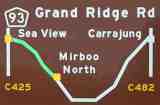
The Grand Ridge Road starts at Seaview, about 15 kilometers south of Warragul in western Gippsland, Victoria, Australia. It runs east and south through Hallston, Mirboo North, Gunyah Junction and Ryton Junction, then north-east to English's Corner, Balook, Blackwarry and finally to Carrajung, about 15 kilometers south of Traralgon. It has been called one of the most scenic roads in the world. And without a doubt, it is. However, it's definitely not one of the best roads in the world, any more than it's one of the best-known. In fact, in some places, and at some times of the year, it's possibly better avoided altogether. In its total distance of just over 135 kilometers, or almost 85 miles, its quality can vary from that of an acceptably fast two-lane rural highway to a rutted and washed-out goat-track that's seen a few too many timber trucks (whose drivers in all fairness, I hasten to add, nevertheless treat it with due respect). Driving along the road today, you can't fail to be impressed by the knowledge that most of the road was designed and built to service the needs of the settlers of the remote hill communities long before powered road construction equipment was in everyday use, which makes it an even more impressive engineering accomplishment. It begins at the western end as a firmly-based gravel road, but almost half of its total distance is bitumen, in two installments that are separated by a further 45 kilometers of dirt road. It's not likely to happen this year, or probably even this decade, but eventually, inevitably, it will almost certainly end up paved from start to finish, so if you intend to drive it, and want to experience the flavour of what it's been like for most of the time that it has existed, you should plan to do it SOON!. The road runs along the top of the Strzelecki Ranges, a southerly outcrop of Australia's Great Dividing Range. This area was first explored in 1840 by the Polish-born adventurer of the same name, to his considerable peril, but it was not settled until 30 years later, when its earliest pioneers -- many unskilled, and most of them inadequately prepared -- acquired land on the understanding that they would clear vast reaches of some of the then-tallest timber in the world, often to their (and certainly to later generations') considerable loss. The terrain that the road traverses and the views that it overlooks will give you a glimpse into how difficult their lives must have been. But in the right car, it's a joy to drive on -- so much so, in fact, that I try to take the trip roughly every month, in all weathers. It's not a trip that requires (and nor will it help to justify) your monster 4WD, which could even be an impediment in some places -- there have been times when I've slipped through underneath trees that have fallen across the road that would stop a taller vehicle in its tracks. Nor is it a drive to be undertaken in a fragile or elderly vehicle, although I occasionally see signs of vintage car rallies having taken place along quite remote parts of the road. This site describes what you can expect to see along the way, but be warned that it's also something of a tribute to my own preferred mode of transport, the little Peugeot 306 XSi that I bought in 1996, and its more recent successor, a 206 GTi, both of which have made the journey even more of a pleasure. What follows, then, is my personal guide to South Gippsland's Grand Ridge Road along the top of the Strzelecki Ranges, composed of some one hundred or so photos that I've taken on a number of trips that I've made along the road since 1999. I think it's a great driving road, with some of the most attractive scenery in the state, if you're at all into bush views and hillscapes. |
Click on any of the thumbnail pictures below to see a larger original.
|
|
Coming from Melbourne, we start at the western end of the road. We've already traversed some pretty spectacular hills on the 15km south from Warragul, down past the Wild Dog Winery and the Department of Sustainability and Environment's Ellinbank Research Farm. The road ahead leads to Korumburra on the South Gippsland Highway, or -- about 5km further along from this point -- offers a turnoff west to Poowong, and an abrupt, then more gradual descent down the western end of the Strzeleckis to Lang Lang via Nyora. |
|
|
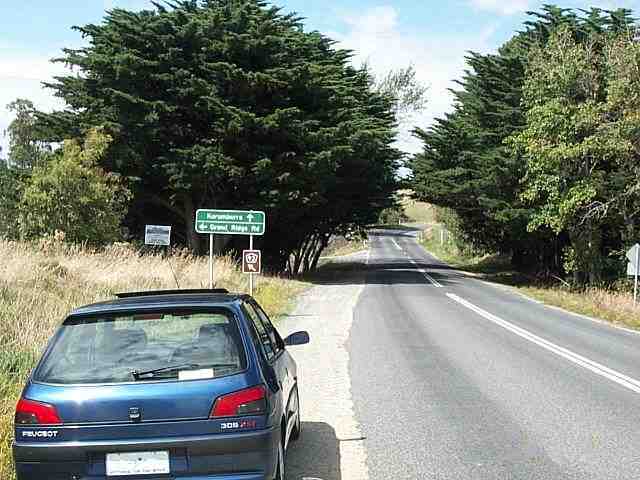
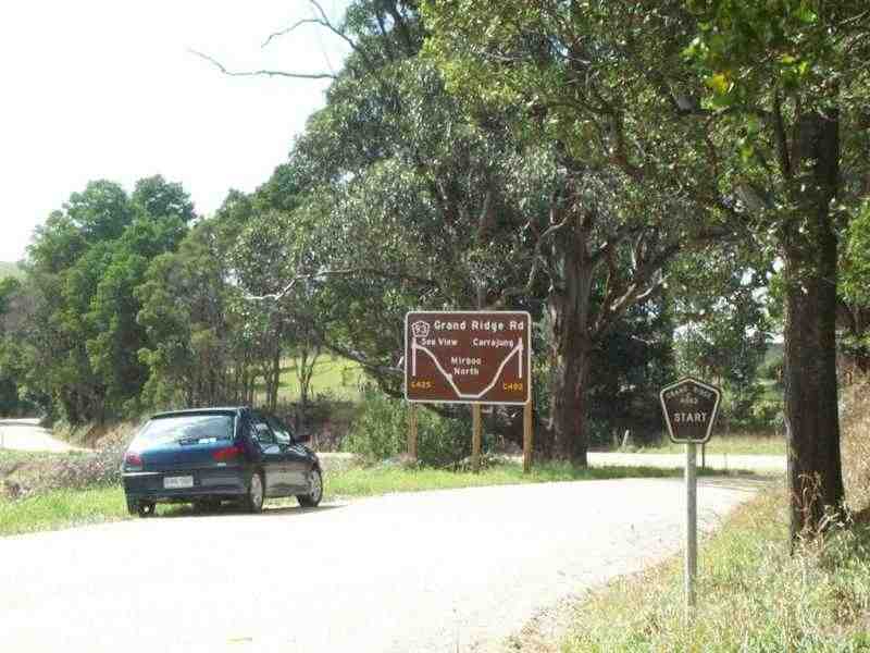
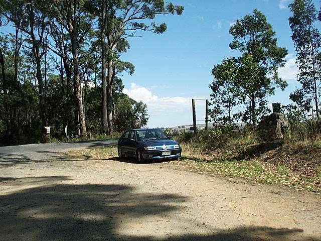
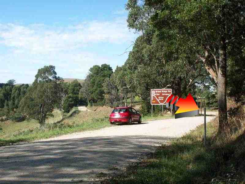
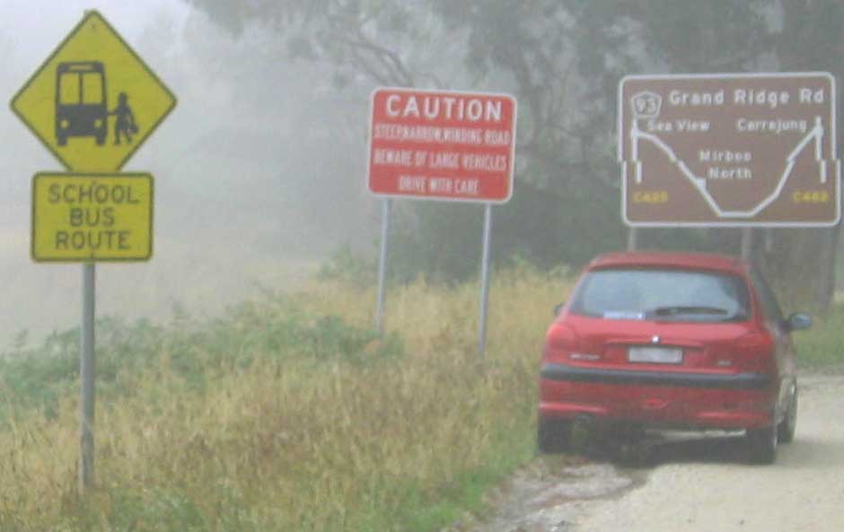
But we turn east, left onto a firm gravel road, and see the same road sign that we'll also see at the far end of the road. This photo was taken on a midsummer drive, in February, 2000, in the days when there was still a sign under the tree in the foreground (R) marking the start of the road. By April, 2002, when this photo was taken, it had been souvenired as somebody's private trophy (and no, not by me). |
|
|
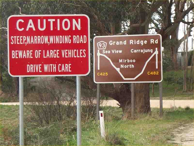
Just in case there's any remaining doubt about risks along the road, this sign was added at the western end of the Grand Ridge Road in mid-2002. But if you take it easy, and can keep your wits about you for the next 136 kilometers, you shouldn't have a problem. By early 2004, the roadside grass had grown a bit, intervening wind storms had done their work on these signs, and a further sign had been added to perhaps mellow your initial impressions of what you're in for ... |
|
|
If you're up to it, take your eyes off the road for a quick glance to your left, to the north. Then you'll want to stop the car for a better look that isn't quite so risky. Just don't do it in the middle of (or even anywhere close to) a blind corner, but rather somewhere where approaching drivers -- from either direction -- have time to see and avoid you. Or, simply take a look ahead across the valleys instead. This should give you a glimpse of what much of the next 130-odd kilometers is going to be like: on the whole, civilized, but perhaps a bit edgy, and picturesque as hell. |
|
|
Into the first of the overhanging trees at Seaview.
|
|
|
You'll have covered about 7km by the time you see this STOP sign at Seaview. The bitumen to the left takes you back towards Warragul down a picturesque (if narrow) lane that's a worthwhile drive in its own right, but we turn right and keep going on the dirt. |
|
|
It's a bed'n'breakfast, not too far along the road -- at least, I hope it is, because they won't thank me for advertising the tranquillity of their location if it's not -- but I'm always amused by the name.
|
|
|
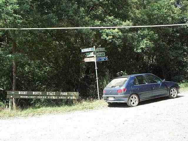
At the Mount Worth State Park turnoff in March, 2000, a worthwhile detour if you're after a picnic spot or a panoramic view. This side-road is the continuation of McDonald's Track, named after the Scottish-born surveyor, G T McDonald, who arrived in Victoria in 1853. It was McDonald who first mapped the 70-mile path -- followed by many later settlers -- that ran from Lang Lang, on Western Port Bay, east across the ridge through its then-dense forest to Morwell in 1862. |
|
|
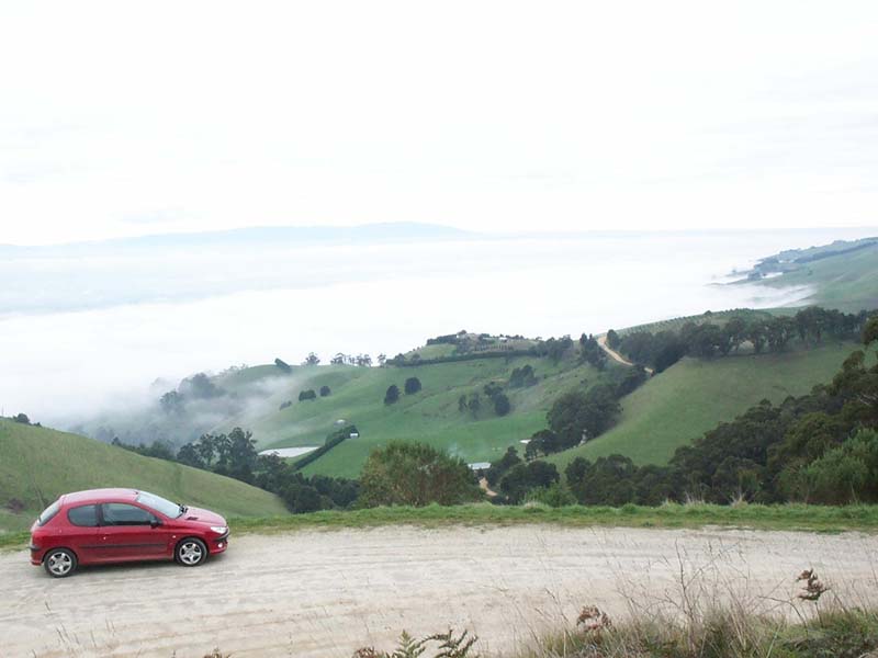
DETOUR: I'm assured that the view from Mount Worth over the La Trobe Valley is usually a lot clearer than it was on this day in July, 2001, when really low-lying fog obscured just about everything. |
|
|
...but sticking to the main Grand Ridge Road, we continue on along the gravel to the right, and are soon back into patches of forest again. |
|
|
In case it's not yet apparent, I should tell you that this is not a tour for the claustrophobic. In places, you'll feel as though you're driving through a tunnel, but at other times, the horizon simply falls away in all directions. As you might expect, though, you should try NOT to be the first person to drive along this road after storms. It's generally pretty well maintained, but don't push it, OK? |
|
|
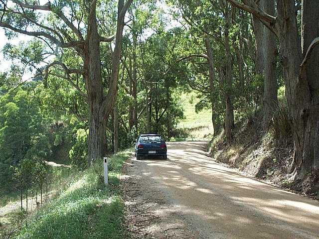
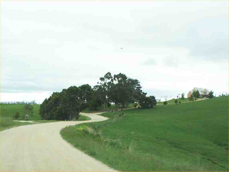
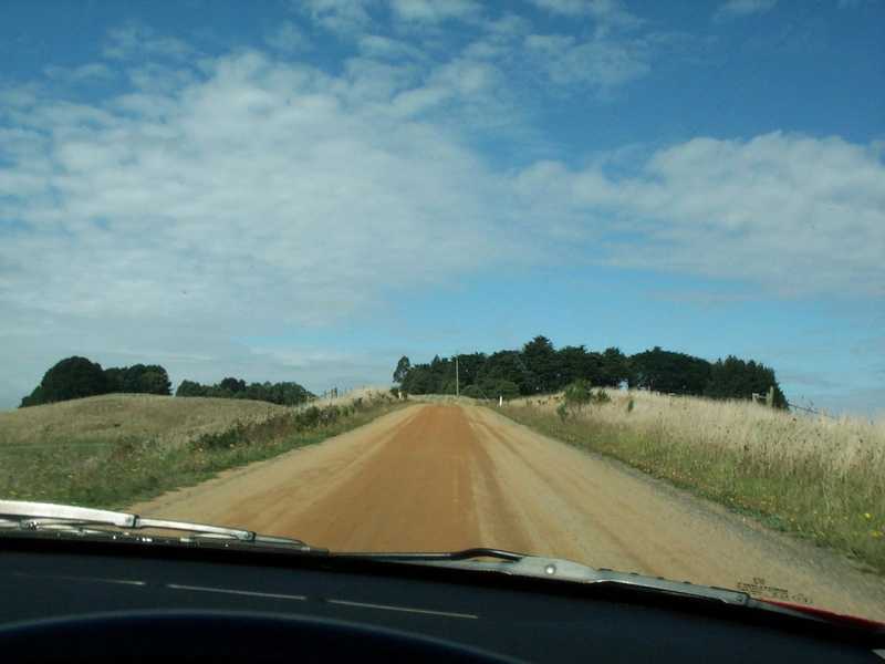
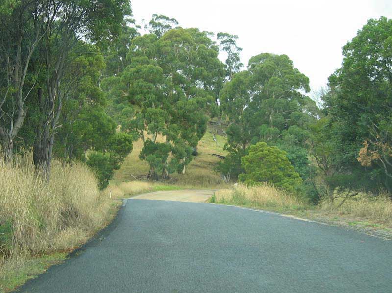
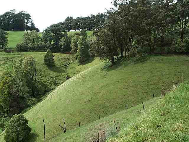
A slightly less demanding geography here at the western end of the Strzeleckis means that the Mount Worth forest area gives way to predominantly open dairying country. By the time you reach the eastern end, you will have seen that give way to timber. A lot of the early part of the road is like this -- firm gravel that can become very dusty in summer but stays firm in winter, and which is generally speaking very attractively laid out and a pleasure to drive on, but hazardously loose at any significant speed if you're not accustomed to it. |
|
|
Onto the red gravel. Already it's difficult to believe there was ever tall timber here, let alone forests so impenetrable that Strzelecki's overland expedition from Sydney to the settlement at Western Port Bay in 1840 was in places unable to advance more than three kilometers a day. Having abandoned their horses and supplies further to the east, they were at times obliged to physically throw themselves at the thick walls of scrub in order to make any progress, and came perilously close to starvation. |
|
|
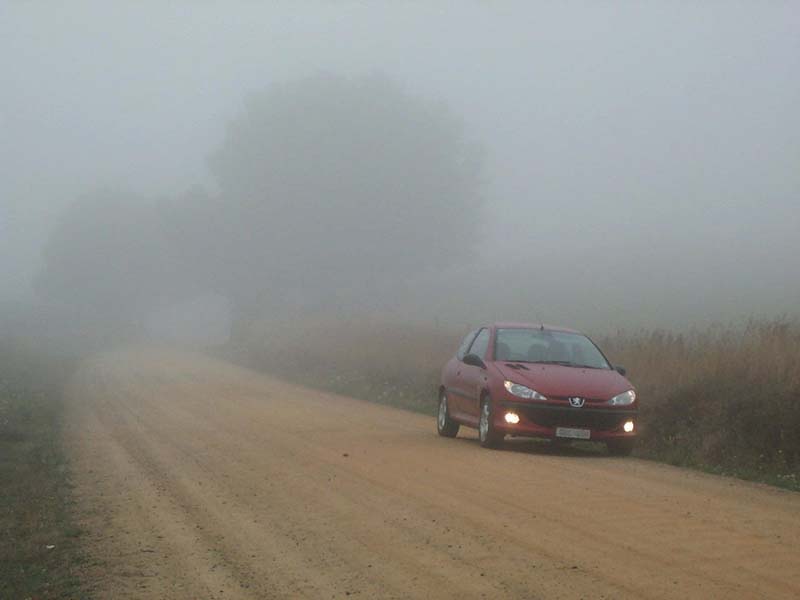
Very atmospheric. This was a rainy April morning in 2002. I haven't explored the road all that much in winter, but as this picture shows, there are times when you might need to beware of fog. It is not common, but nor is it unknown for snow to fall in places, too, notably at the eastern end of the road around Balook (although I've never seen it), but as far as I know, not enough to warrant the use of chains. |
|
|
After passing through some rich dairying country -- where you'll need to be on the lookout for the occasional stray cow or two around Trida -- we return to the bitumen at about 23 km into our journey. Try to resist the temptation to floor it once you get a firmer surface underneath you, because you'll soon be taking the first left turn to Hallston (named after local pioneer settler Thomas Hall), which sneaks up on you before you've gone more than a couple of kilometers. |
|
|
About 25 km in, the road through Hallston that was opened in 1994 is a good, early example of a turnoff that you could easily have missed, until the recent addition of a prominent signpost just before the crest of the hill that hides it as you approach. At many other intersections along the road, the signs are not always too well maintained. Or even present. When they are, they're sometimes ambiguously positioned, and further on, the wrong road can sometimes be difficult to reverse out of, so try to keep an eye out for the signposts that delineate highway 93. |
|
|
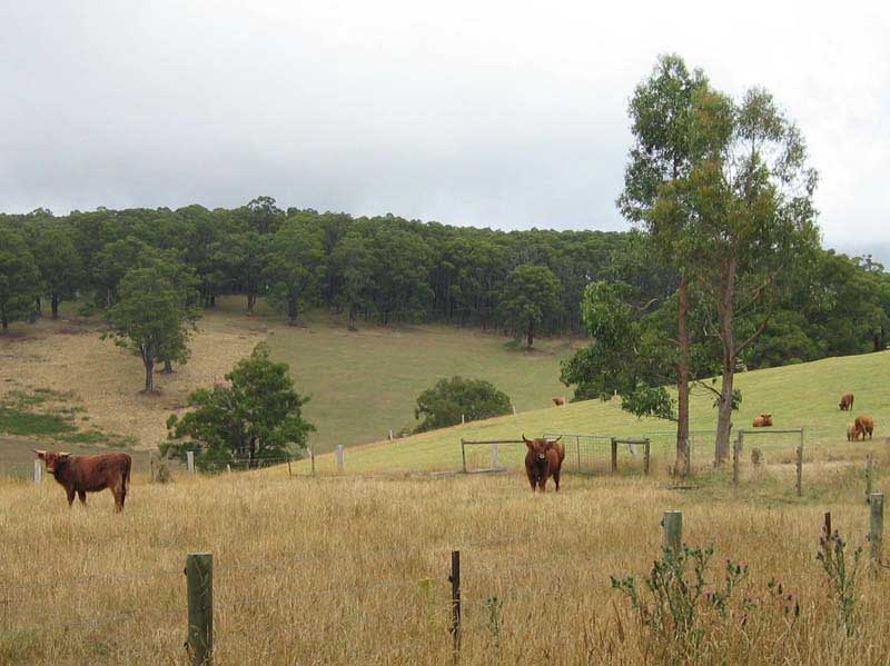
In Hallston proper, turn right and it's a speed-limit run in places on quite a good stretch of road. If you look to the right after about two kilometers, you might be surprised to see a herd of longhaired, longhorned Scottish Highland cattle, which you're only otherwise likely to see in a zoo. The scotch thistle that's growing along the fence-line in the foreground is obviously somebody's effort to make them feel even more at home ... |
|
|
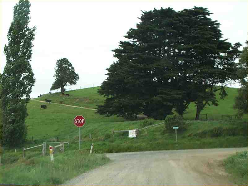
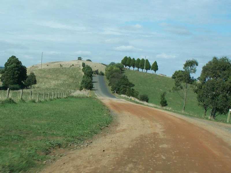
There's a fairly straight 3km continuous-downhill run to the Yarragon road intersection at Allambee South (shown here), but once you get to the bottom, you come to a very emphatic STOP sign that only a fool would ignore. For an interesting diversion, you can also take the original "Old Grand Ridge Road" around the back of the hill on the way down, although the surface is nowhere near as good. |
|
|
From the Yarragon Road corner, you're also likely to encounter a couple of gaps in the road surface, like the one shown here, that seem to have defied repair for a number of years to my knowledge, and may represent areas of chronically unstable ground. It's an engaging, winding piece of roadway otherwise, though, right up to the point where it joins the Strzelecki Highway which runs from Leongatha in the south-west, via Mirboo North, to Morwell in the north-east. |
|
|
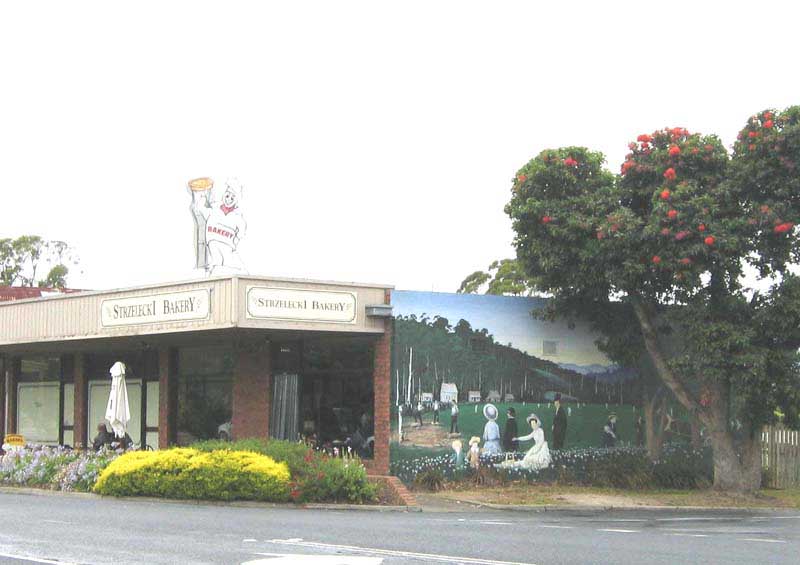
The Strzelecki Highway, north-east to Morwell or south-west to Leongatha, is your last "easy exit" if it's all proving too hard for you. In any case, take a mental-health break when you reach Mirboo North, about 42 km from where we started at the western end. Many buildings in the main street, such as the Strzelecki Bakery shown here -- a fine place to buy your lunch, by the way -- are decorated with historically-themed murals. |
|
|
First settled in 1884 as a timber and dairying town along the ridge dividing the Tarwin and Morwell River watersheds (and which gives the road its name), Mirboo North promotes itself today as "The Town On Top". A major tourist destination in Mirboo North is now the Grand Ridge Brewery and Restaurant, established in 1998 on the site of the the town's former butter factory. |
|
|
Any questions or comments? |
|
© 2004 BEB Consulting


