|
|
Stage III -- Gunyah Junction to English's CornerDistance: approx. 25 kmSuggested time: approx. 50 minutes |
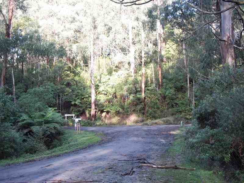
From Gunyah Junction, the Grand Ridge Road meanders some 12 kilometers northeast through the hills to Ryton Junction, then for a further 13 kilometers to English's Corner. This stage is probably the deepest part of the forest, and it will already have become evident to you that the eastern half of the road is probably not as well-maintained as the western half. Or maybe it's just because it's wetter here for more of the year, or because this part of the road carries less traffic generally, and more timber trucks.
Remember, click on any of the thumbnail pictures below to see a larger original.
|
|
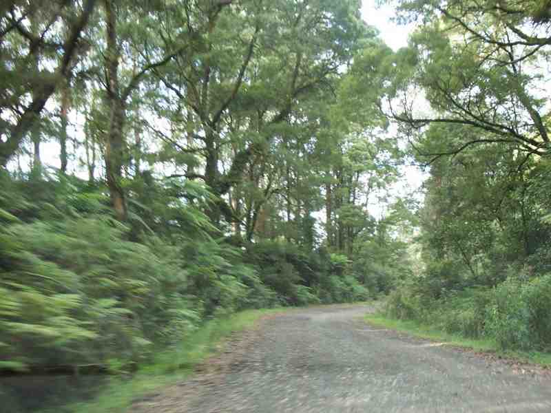
This is very typical of a lot of what you'll see from here on. The road surface remains firm without too many potholes, but you'll occasionally find it to be corrugated on some bends. The road drains well, and you can usually be confident enough of its stability to drive around corners on your own side of the road, rather than in the middle, an important consideration when you can't always see what's coming. |
|
|
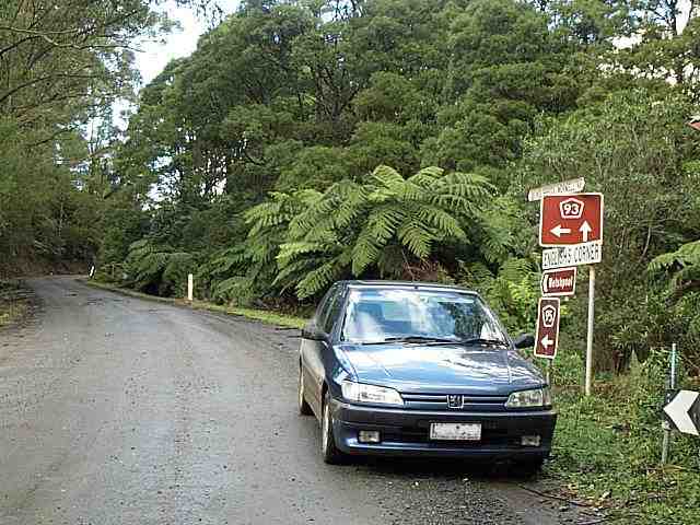
You're running downhill when you come to this turnoff, about 5 kilometers on from Gunyah Junction, where 93 goes left. Some other time, you should take the more-travelled Toora-Gunyah road to the right, which leads to a steep descent down to Toora on the South Gippsland Highway, just for the sake of the breathtaking views where the Strzeleckis fall sharply into the brief coastal plain. On the way, you won't be able to avoid seeing the elegant turbines of a new wind farm that tower hundreds of meters over the tops of the hills above the Toora township. |
|
|
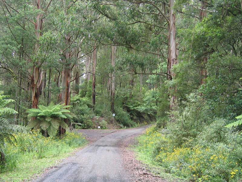
About 3 km further on, you'll come to this fire track, at a very picturesque bend in the road.
It becomes a lot less picturesque if you go for a walk even only as far as the nearby top of the hill, because before very long, you'll come across the skeletons of four or five stolen cars, stripped and dumped in the scrub. |
|
|
But if you stay facing the road, it's still pretty ... in fact, it's darned pretty. More than once, I've seen people set up with picnic lunches on this corner. Call it corny, but country courtesy demands at least a brief wave when you see such people sharing your enthusiasm for the beauty of the area. |
|
|
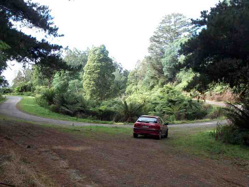
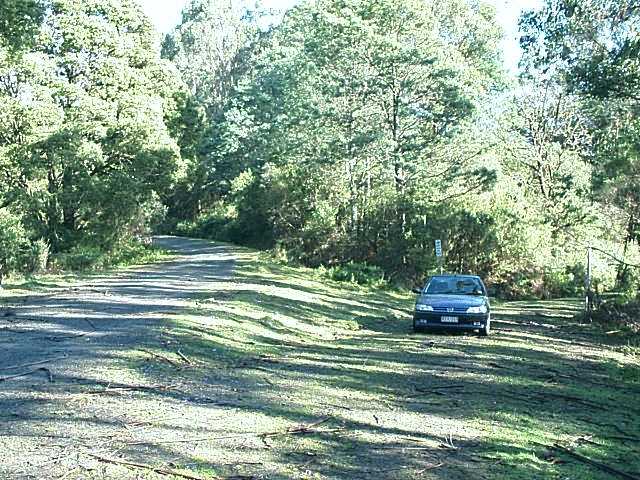
A kilometer or two further on, you come to the junction of the Grand Ridge Road (L) and the little-used Morwell River Road (R). I pulled over to park on the river road here in March, 2000, but I didn't explore it, because it looked as though it ran off downhill quite steeply, and I wasn't sure exactly where it would go when it got to the river (though I've since found that it's only one of a number of roads up from the site of the former prison farm and timber nursery). |
|
|
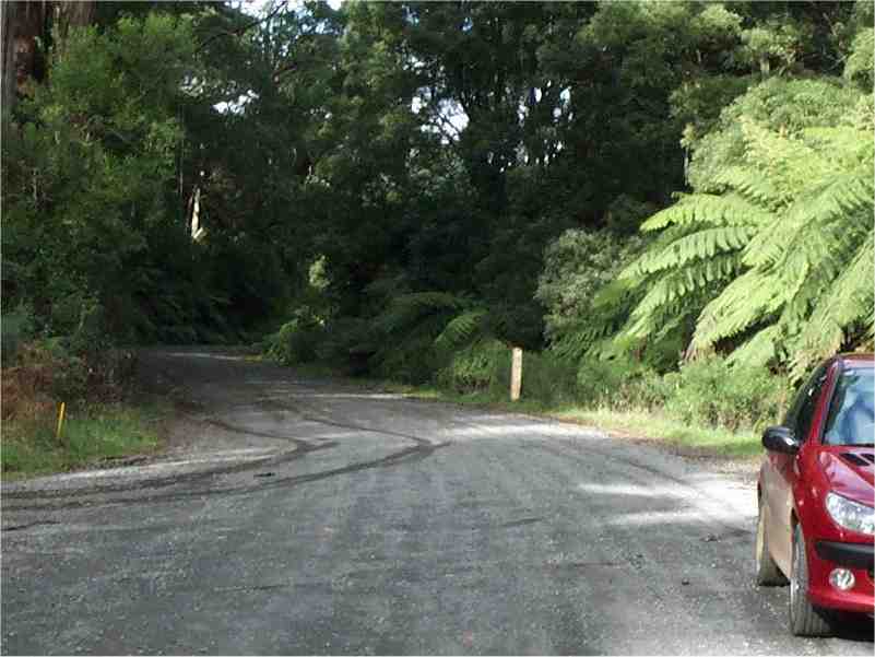
Parked in the same position at the Morwell River Road junction two years later, on a dirtier day and in a different car. The other reason I've never investigated this road is that I've learned from previous experience with unplanned detours not to trust the tracks that have grass growing in the middle of them, as this one does ... |
|
|
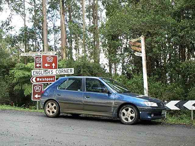
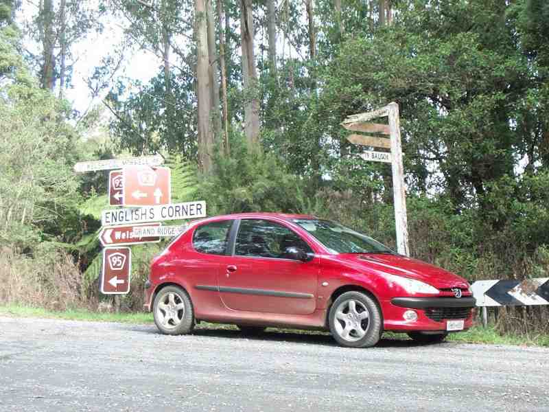
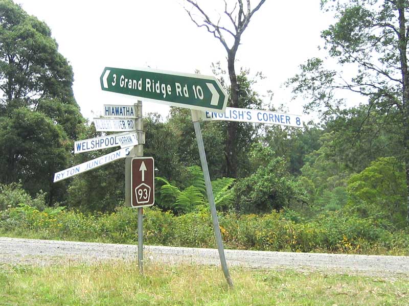
I shop for my lunch in Mirboo North, but here's where I like to eat it -- about 40kms further on, at Ryton Junction, a sudden clearing that you come upon where the road cuts back on itself where it meets the Midland Highway up from the coast at Welshpool. Obsessive Peugeot-philes (like me) might like to cross themselves at this point, since all right-hand drive Pugs these days are built at Peugeot's factory in Ryton, Coventry, in the UK. |
|
|
There's a cement picnic table and six seats set in the side of the road, but the real attraction is simply the isolation, and the sounds of the bush, whose sheer density cannot fail to impress you. You can sit here for most of an hour in the middle of the right day, and you'll be lucky if even one other car goes by. You might enjoy it, as I do, or you might find it oppressive and intimidating. Either way, it's probably not a good idea to wander too far off the road ... |
|
|
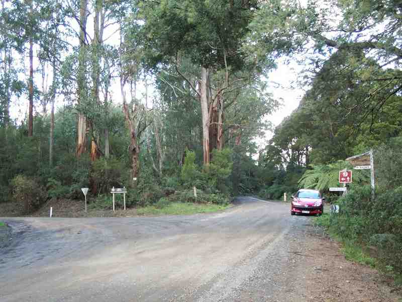
The Grand Ridge Road from Mirboo North arrives here from the right at the rear of this picture -- the other road, coming around the bend from the far left, is the Midland Highway from Port Welshpool, down on the coast to the east of Wilson's Promontory. A visionary, if somewhat disjointed, "outer ring road" of almost a century ago, and a highway at this point in name only, it runs down to Morwell, then restarts at Mansfield and continues via Benalla, Shepparton, Bendigo, Daylesford and Ballarat to Geelong on the other side of the state. |
|
|
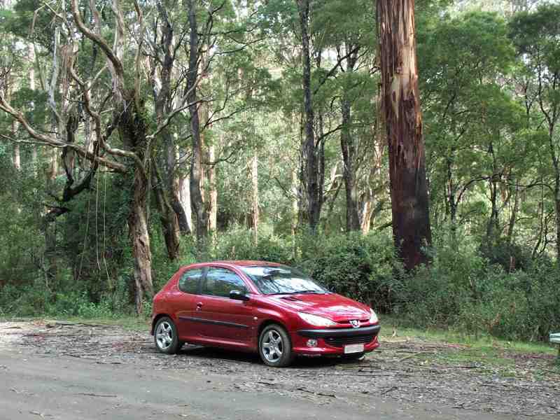
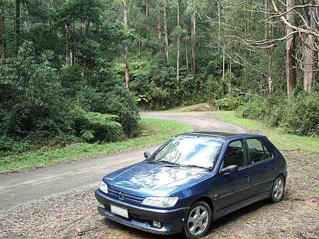
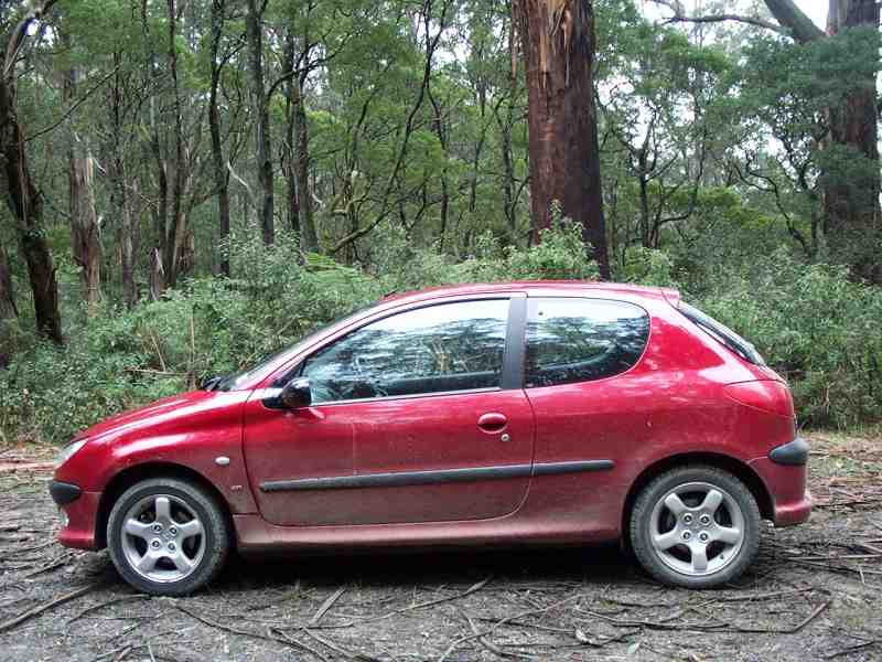
And now a few words about The Cars, which are just made for this sort of road. This one was a stock standard Peugeot 306 XSi hatch (well ... I added the sunroof), with an 8-valve 2-litre engine and a 4-speed ZF automatic gearbox. I owned it from new, but I sold it at 100,000kms, mistakenly thinking it was getting a bit long in the tooth. I wish now that I'd kept it longer, because it was a very comfortable tourer that should last for a long time yet. |
|
|
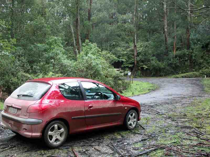
The 206 GTi's appeal was its grunt, its handling, its manual gearbox and its -- only slightly -- more compact size. I bought it with ease of city parking in mind, but its real strength is touring. I've now done more than 100,000km in this car, and can see it lasting for at least twice that distance with few problems. And I don't exactly pamper it.
I just wish I'd found out about these cars sooner -- safe driving is basically about going, turning and stopping, and these are the very areas in which they excel. Fellow fans of the GTi will find like minds congregating at 206gti.net. |
|
|
The GTi is much faster off the line, as you might expect, but out on the road, both cars benefit equally from having relatively small, rugged bodies with relatively powerful 2-litre engines with lots of low-end torque, a formula that lets you start to accelerate up hills just at the point where the family sixes start to flag. Best of all, their suspension and steering will let you hurry through the bendy, up-and-down bits, where they both hang on around the corners like a white line. |
|
|
Both have best-of-breed, you-beaut anti-skid braking systems (ABS), but be warned -- on a gravel road, all that they're going to do is to age you prematurely by letting go just at the point when you were hoping they would lock up. Strong nerves and quick reflexes will help you up to a point, but a road like this is more enjoyable if you can be confident that your car is going to go where you point it if you're obliged to change direction suddenly. And sooner or later, you're going to have to. More on that soon ... |
|
|
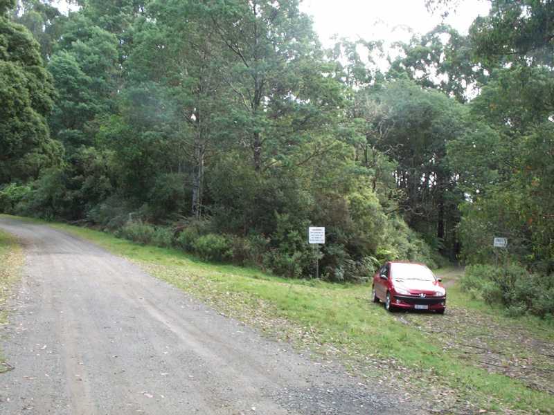
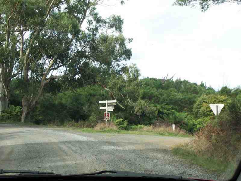
Some four kilometers from Ryton Junction, you'll reach the turnoff to Albert River, named, naturally enough, in the late nineteenth century when the area was settled, for Queen Victoria's consort, and also to Hiawatha, presumably named for Longfellow's then-popular poem. We continue straight ahead. Last time I came by here, touring morons had bent every road sign on the central tree. |
|
|
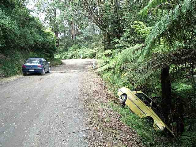
A little further on, I once came across this car, whose very lucky driver may have thought he had a Peugeot -- came around the far bend too fast (I assume), over-corrected and ricocheted off the inside bank, over the edge. I noticed that the windshield was cracked, and the driver's window was open, but I couldn't see anyone in the car, and nor could I hear anyone. But I didn't get any closer than the edge of the road, because all that was stopping this car from hurtling down what I suddenly realised was a very steep hill was the shallow-rooted tree-fern that it was leaning against. I later learned that the car had been there for five days. |
|
|
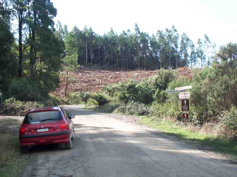
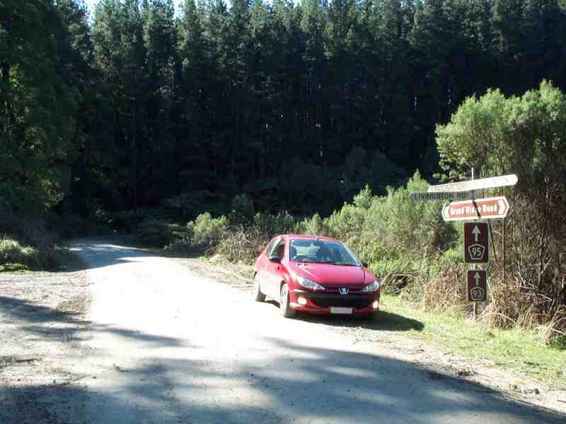
Now and again you'll break out of the trees into a sudden clearing like this, especially towards the eastern end of the road, where more of the forest has been cleared. This is at Livingston Road, a good example of the way place names come about in such areas. "Livingstons" were early settlers, and the road may well have gone to their property, but these days, it's not just a name commemoratively assigned to the road, but also the name of the district that is its destination. |
|
|
This is the same shot from an earlier drive, only I'm coming from the far end of the road this time, and if you compare this picture with the previous one, you can see how different this area looked until relatively recently.
Get used to this sort of contrast, because you'll see a lot of it at this end of the road. |
|
|
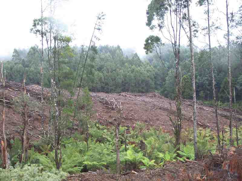
The eastern end of the Strzeleckis contains many areas of newly-planted softwood as well as more mature plantations of conifers sprinkled among replanted native forests.
[EDITORIAL: ON] To our enduring shame, successive (state) governments have been complicit in selling plantation rights to vast areas of these hills to American superannuation companies for a pittance. Now, some of my best friends are Americans, and I wish them all a comfortable retirement, but even so ... |
|
|
In its simplest form, a pine plantation is just a nuisance when storms litter the road with large pine cones, and one that becomes a lurid eyesore at harvest time, as shown here. But at worst, it's a vehicle for selling the farm by stealth, in the form of licensed theft by export of already-sparse nutrition from the topsoil of these fragile hills, at the expense of large and diverse areas of native vegetation. [EDITORIAL: OFF] |
|
|
Storm damage on the road near here, late one April, at a point where I had stopped to clear a small wattle tree off the road. A trip like this on a day like this will remind you what those "hey-look-at-me" lights are really for -- you only need to be surprised once or twice by someone coming the other way around a corner as fast as you, to want to give yourself every possible chance of being seen through the trees from as far away as possible. |
|
|
For some reason, I often seem to find myself trying to take this innocuous-looking flat bend beyond Ryton Junction just a bit too fast. I think it's the combined effect of coming out of a stretch of improving road surface among the trees at a reasonable turn of speed, a bend whose radius gets progressively tighter, and some pretty bad corrugations that you don't tend to notice until you're in the middle of them. |
|
|
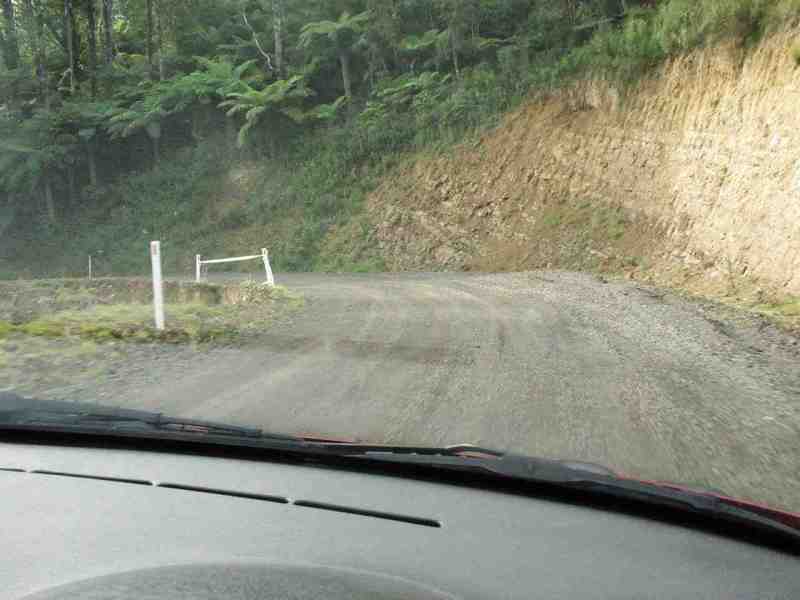
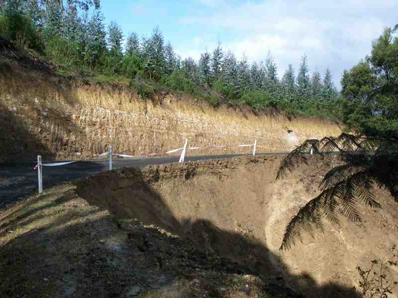
You'll want to get out and take a closer look, but don't until you're well and truly past this point, where the road has been excavated further into the hill as a result of earlier washouts, possibly compounded by the combined weight of many timber trucks. I don't hold this sort of collapse against their drivers, who, as far as I can see, are fairly responsible and in fact go out of their way to avoid needless damage and restore any damage that they do cause. I just prefer to drive along this road at a time that lets me not share it with them if I don't have to. |
|
|
Here's the reason you'll want to get out and take a closer look -- because (fortunately) it's not until you're actually driving past it that you'll see just how sharply the road drops into the very steep gully on the inside of this corner. |
|
|
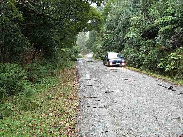
And barely a kilometer on, after what seems like an endless stretch of increasingly rough bush track, you'll come around a bend, and suddenly find yourself at English's Corner, named for Walter English, one of the earliest settlers in the district. This was on a wet June day. |
|
|
At English's Corner in April, 2002. Note the condition of the original timber signpost -- the newer metal signposts are directed towards traffic that's arrived here from Morwell (ie, ahead, to the right of this picture), rather than the way we've come, along the Grand Ridge Road. |
|
|
The road we've come down to arrive at the same spot at English's Corner. This was in June, 2000, wetter and dirtier, and under a somewhat more overcast sky. |
|
|
Another time, at the same corner -- this was taken shortly after an oncoming car with five or six people in it overshot this corner wildly, directly in my path, as his skid-marks show. I had no choice but to brake sharply, while at the same time trying to steer out of his way. He just backed up sheepishly and then continued briskly on his way, but I'm quite certain that the other car's driver would have been on the wrong end of an ear-full of abuse from his passengers before he even got around the first corner. |
|
|
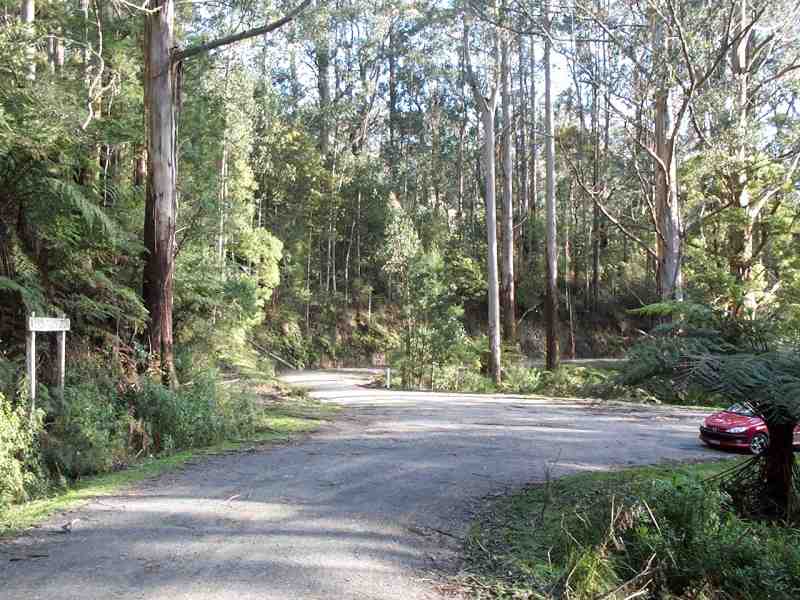
Here's why he made his mistake -- the Grand Ridge Road cuts back quite sharply to the east, towards the Tarra Bulga National Park to the left of this picture (ie, we should turn right), but you'd be correct if you thought it wasn't all that well signposted, particularly from the direction that we've come. Barely forty kilometers of the road to go. |
|
Any questions or comments? |

|
|

|
© 2004 BEB Consulting


